Mount Dromedary and Cape Dromedary
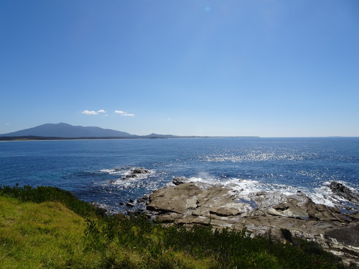
Grade 5: Mount Dromedary is a major and imposing Landmark on the coast, and visible from as far as Cook’s Pigeon House mountain nearly 100km to the north. The view from The Slot at Bermagui shows the Mountain, Cape and ‘peaked hillick’ from Cook’s direction of approach. The mountain is well worth climbing, though views from the summit are limited. At Mystery Bay you can stand on Cape Dromedary, with Montagu Island visible well off shore.
Situation: Between Narooma and Bermagui, New South Wales south coast. Good road access to Cape at Mystery Bay. The 11km return walk to Mount Dromedary starts to the right of Pam’s Store, Central Tilba.
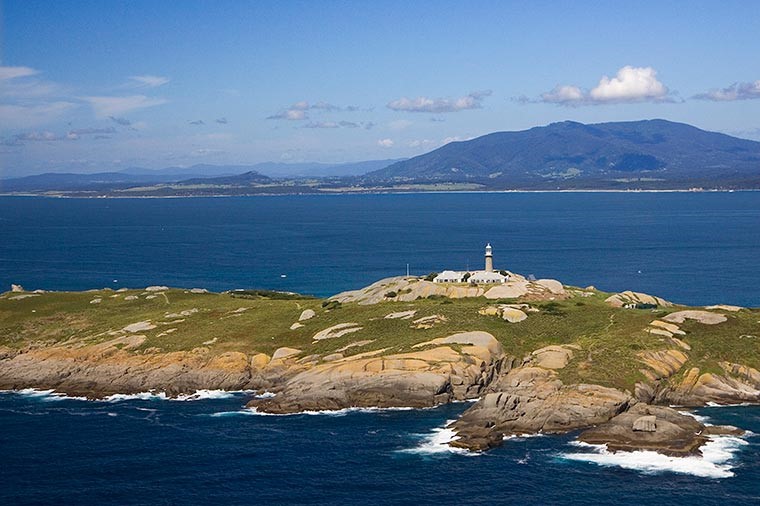
Aboriginal names: Mount Dromedary: Gulaga (Dyirringan-Yuin people). The mountain Gulaga is the mother and Barungula (Montague Island) and Najanuga (Little Mount Dromedary) are her sons.
Coordinates (decimal):
Mount Dromedary: 32.72 S 145.88 E
Cape Dromedary: 36.30 S 150.13 E
Endeavour Journal, 21 April 1770:
At 6 oClock we were a breast of a pretty high mountain laying near the shore which on account of its figure I have named Mount Dromedary (Latde. 36.18S, Longde. 209.55W). The shore under the foot of this Mountain forms a point which I have named Cape Dromedary over which is a peaked hillick.
Cook named the mountain Dromedary because of its resemblance to a camel’s hump, and the ‘peaked hillick’ is now known as Little Mount Dromedary. He describes the mountain and cape clearly and they appear on his charts. Both appear on today’s maps where Cook placed them. However Cook’s Cape Dromedary is widely regarded as being nearby Montague Island, as an internet search for the history of the island will reveal. Matthew Flinders was the first to conclude that this was this case, reported this in ‘A Voyage to Terra Australis’, and omitted Cape Dromedary from his charts. Flinders’ erroneous conclusion still dominates, and some historians have continued to accept Flinders’ version of events. Flinders’ error was recognised by hydrographer John Lort Stokes in 1851 and the Cape appears on his charts where Cook placed it, and has remained there to this day.
In ’A Voyage to Terra Australis' Flinders wrote:
When captain Cook passed this part of the coast his distance from it was five leagues, and too great for its form to be accurately distinguished. There is little doubt that Montague Island was then seen, and mistaken for a point running out from under Mount Dromedary; for its distance from the mount, and bearing of about N. 75° E., will place it in 36° 17', or within one minute of the latitude assigned to the point in captain Cook's chart.
Flinders had visited the area twice in 1798, on both occasions approaching from the north, while Cook approached it from the south.
Cook would have had clear views of the mountain, ’peaked hillick’ and cape from the south east from 5 to 6 leagues away from Cape Dromedary before nightfall. Cook’s description is precise, ‘The shore under the foot of this Mountain forms a point which I have named Cape Dromedary over which is a peaked hillick’. The ‘peaked hillick’ is Little Mount Dromedary (140m), a distinctive peak, and the shore near the Cape has land up to 40m high. From 6 leagues, allowing for the curvature of the earth, and viewed from Endeavour’s rigging at a height of 18m, land less than 26m high would not be visible. The Cape would have just been visible and the ‘peaked hillick’ would have appeared as a feature nearly 114m high.
Montague Island is north east of Mount Dromedary and more than 3 leagues (19km) from the mountain, hardly at its foot as Cook describes. Cook had seen and named both Mount Dromedary and the Cape well before he reached the area of Montague Island. If he had seen Montague Island and mistaken it for the Cape, the coastline on his chart would be much further out to sea than it is, as the island is 5 miles off the nearest coast. Further, the island at its highest point is 47m and does not meet Cook’s description of his Cape ‘over which is a peaked hillick’.
All the evidence points to Cook having seen and named today’s Cape Dromedary and not Montague Island. But how did Cook miss seeing Montague Island? Flinders himself provides a possible explanation in his journal entry for his first sighting:
We were surprised to find an island lying near two leagues off the coast: none being noticed by Captain Cook, who passed this part on a fine morning, as appears by his getting lunar observations; which circumstance indeed, from engaging his attention, might have been the reason he did not see it.
The island is low lying and, from Cook’s position to its seaward, would blend with the green hills of the coastal hinterland. Nevertheless it is strange that nobody on Endeavour on that clear morning spotted an island. It is equally strange that Flinders, who sailed inshore of the island and closer to the coast than Cook, did not see the ‘peaked hillick’, a prominent feature.
References:
For more detailed information and sources see:
Trevor Lipscombe, ‘Where is Cook’s Cape Dromedary?’ Cook's Log, Journal of the Captain Cook Society, Vol 41, No 1, January 2018.
Trevor Lipscombe, Is Cook’s Cape Dromedary really an Island?, Placenames Australia, June 2020. (https://www.anps.org.au/upload/June_2020.pdf)